


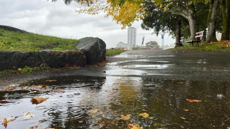
NANAIMO — Much of coastal B.C. woke up to wet and windy conditions Thursday morning, with more on the way.
Environment Canada issued rain and wind warnings for much of Vancouver Island the morning of Thursday, Oct. 23, including the Oceanside area, with only a small sliver from Nanaimo south to Victoria spared from the alerts so far.
Meteorologist Brian Proctor said an atmospheric river system has settled over our area, with the northern and western parts of the island getting hit the hardest, lasting until mid-day Friday.
“We’re looking for a wet period and a windy period setting up, we’ll probably see wind warnings from Nanoose Bay northwards on the east side of the island, and probably still blustery conditions in the Nanaimo area down towards Duncan as well, but not as strong.”
Wind and rainfall warnings are in effect from Campbell River southward to Nanoose Bay, calling for between 40 to 70 millimetres of rain and winds of around 70 kilometres per hour gusting up to 90 in coastal areas.
Proctor said winds of 131 kilometres per hour were recorded on Sartine Island, located west of the northern part of Vancouver Island, on Thursday morning.
Along the Island’s west coast and interior, up to 140 millimetres of rain is expected near Gold River and Zeballos, the highest amount predicted for the region.
The BC River Forecast Centre has issued high stream flow advisories for Vancouver Island from Campbell River south to Victoria, with flood watches in places for areas north of Campbell River.
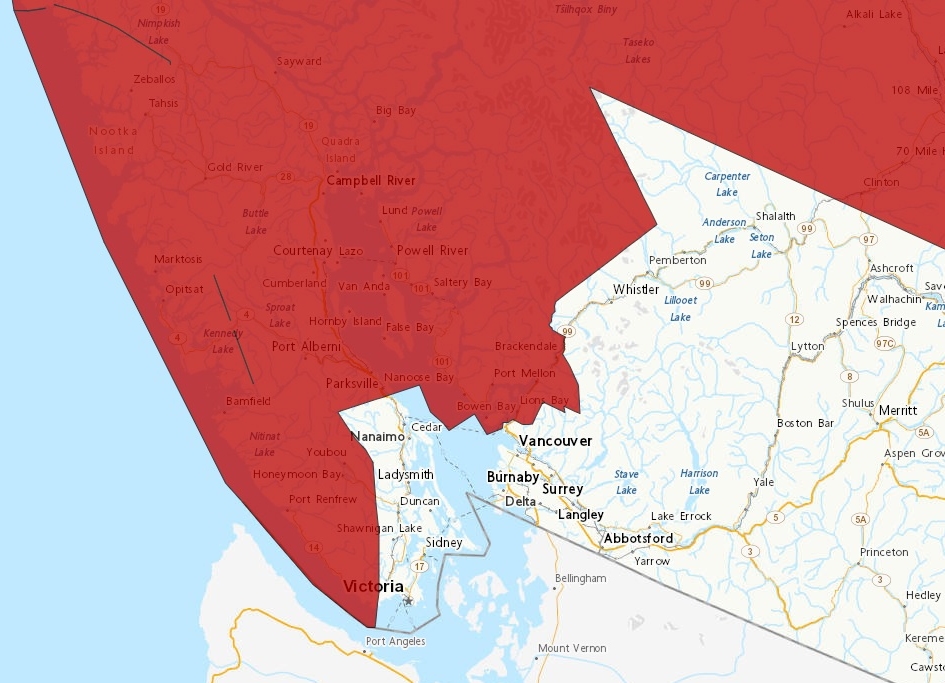 Wind and rainfall warnings are in effect for the majority of Coastal B.C. as of Thursday morning, with only a small eastern portion spared as of 10:00 a.m., from Nanaimo south down to Victoria. (Environment and Climate Change Canada)
Proctor said the wind and rain are expected to ease up a bit Thursday evening, but pick back up again overnight.
“By sort of mid-day Friday, we look at the first system really rotating through, moving east of us and south of us, and look for shower activity through Friday afternoon and Friday night before the next system comes through again on Saturday.”
He said the weekend weather pattern will be similar to Thursday and Friday but with less intense wind, calling it “typical fall storm conditions” for this time of year.
Proctor said the La Niña weather pattern will likely continue for the rest of the fall and into winter, bringing stormy weather with it, which might feel unfamiliar after years of prolonged drought.
He said motorists travelling around the island should be especially cautious in areas affected by recent wildfires.
“If you’re going across the hump into Port Alberni, we may have to watch that burn scar area to see what happens. If we start getting lots of precipitation on that, we can sometimes look for some failure in some of those slope areas.”
The drenching weather has also prompted flood watch bulletins for the northern and central coast, including the Skeena River and its tributaries.
The provincial government encourages residents to be prepared in the event of power outages caused by downed trees and localized flooding near waterways.
More information on how you can protect yourself, your family and your home can be found here at the Emergency Management and Climate Readiness website.
— With files from The Canadian Press.
Local news. Delivered. Free. Subscribe to our daily news wrap and get our top local stories delivered to your email inbox every evening.
info@nanaimonewsnow.com
Follow us on: Twitter (X) | Bluesky | Facebook


